The process

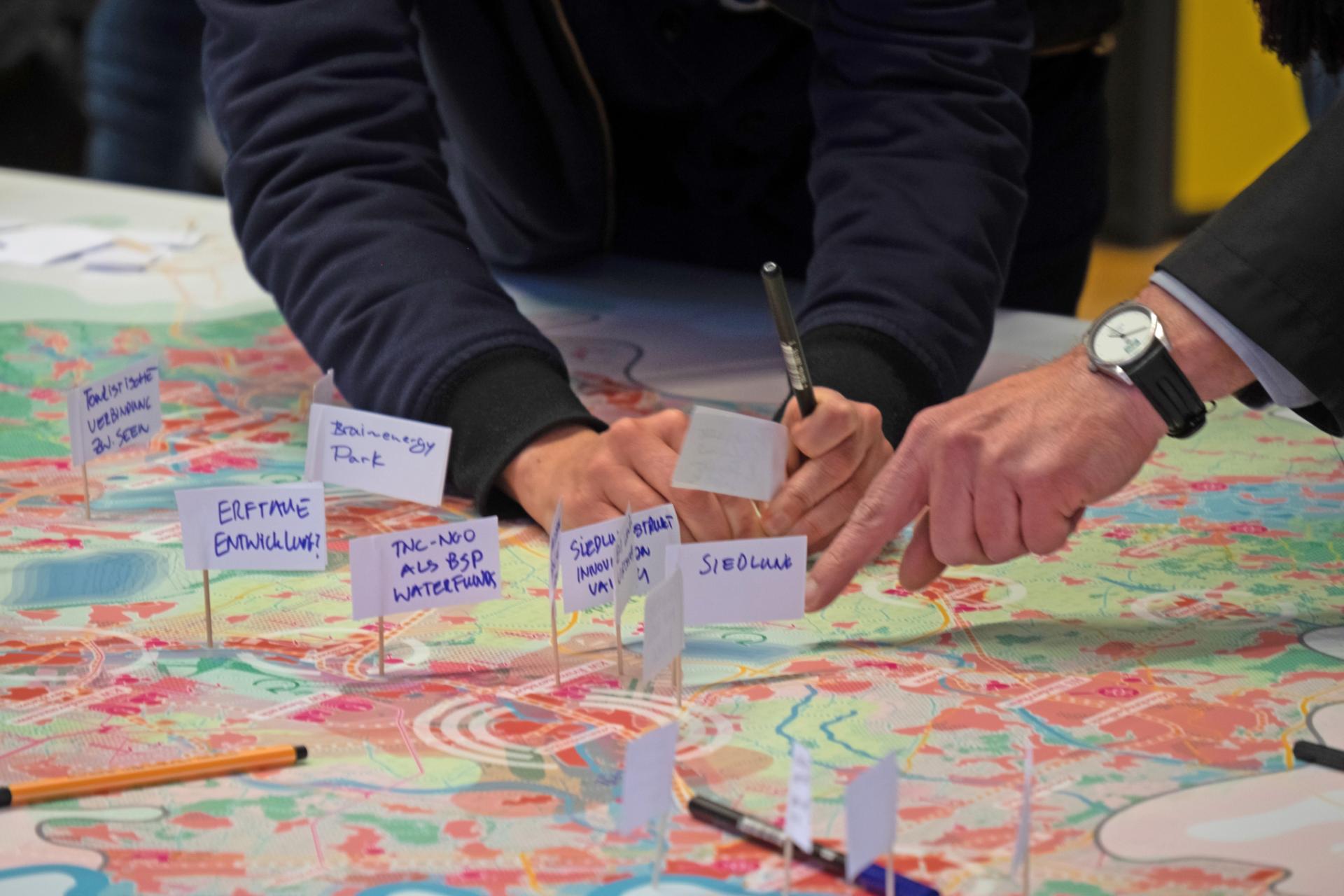
The spatial strategy for the Rhenish mining district 2038+ is a consensus-oriented planning process that attempts to clarify potential conflicts and identify (partially) regional solution approaches through intensive dialog with regional stakeholders in advance of legally binding planning steps. The vision of the future developed in the dialog represents an ambitious future path for the spatial development of the region and achieves a high level of acceptance through constant exchange, thus facilitating the subsequent implementation of planning actions.

The process Phases of the spatial strategy

The planning process is divided into three phases. Upstream and accompanying the process is the dynamic spatial diagnosis, which functions as a continuously updated inventory and analysis and is constantly expanded thematically.

Phase 1 Spatial image variants

Based on the dynamic spatial diagnosis, the three planning teams are developing different variants of spatial models and development goals for the entire Rhenish mining district. The interim results were presented by the three planning teams at the interim colloquium on 10th and 11th November 2021.

Phase 2 Specification

In the second phase, the overall spatial models are deepened and concretized at different scale levels and time corridors, both spatially and thematically.

Phase 3 Consolidation

The spatial images developed by the planning teams are brought together in the strategy paper, the spatial strategy for the Rhenish mining district 2038+. This will be continuously developed and updated.

In-process Spatial diagnosis

Preliminary work / studies of the region

  • Masterplan Indeland
  • Landfolge Garzweiler
  • Tagebaumfeldinitiative Hambach

Studies / Analyses Revierknoten

  • Integrated spatial analysis
  • Basic study on mobility

Current framework conditions

  • Economic framework conditions
  • Filling level of residual lakes
  • Funding lines / implementation projects

Formal planning

  • Regionalplanung Köln
  • Regionalplanung Düsseldorf
  • Landesentwicklungsplanung
  • Braunkohlenplan

Phase 0 | In-process Dynamic spatial diagnosis

Against the background of current developments and the highly dynamic way in which the framework conditions in the region are changing, static analyses in the Rhenish mining district will have only a short half-life, especially in the coming years, and accordingly often only limited informative value. In order to do justice to the dynamics of the process, the analyses are not compiled in the classic sectoral manner, but rather in an action- and solution-oriented manner on the basis of concrete questions. The results of the phase serve as the basis for the concrete content-related task for the multiple commissioning.

Phase 1 Discourse of the spatial vision

In the first phase, spatial visions as well as spatial development goals for the entire area of the Rhenish mining district will be developed in different variants within the framework of the multiple commissioning. After evaluating the existing preliminary work of the region and on the basis of the findings continuously developed in phase 0 as well as taking into account current framework conditions, short-, medium- and long-term perspectives for the region will be elaborated. The results will be discussed and revised in broad-based workshop and participation formats in several phases. The aim of the multiple commissioning is to present the broadest possible spectrum of approaches and options for action. The viable and positively discussed approaches will subsequently form the basis for the overall regional vision and spatial image.

The interim results were presented by the three planning teams at the interim colloquium on 10th and 11th November 2021.

Phase 2 Specification and spatial deepening

In the second phase, the overall spatial models will be deepened spatially and thematically at different scale levels and time corridors. The concretizations are conceptual target statements and concrete approaches to solutions for relevant topics.

The concrete tasks are conceptual target statements and concrete solution approaches for relevant topic areas. They focus on sub-areas or potential areas that are particularly strongly affected by structural change (e.g. opencast mining areas, power plant sites and conversion areas) and on specific implementation-relevant issues. The concrete tasks and in-depth analyses result from the currently relevant issues and requirements for action as well as the identified focal topics from Phase 1.

The final results of the multiple commissioning presented by the three teams on 11.03.2022 can be found here.

Phase 3 Consolidation of spatial strategy 1.0

The results of the various process phases, which have been revised once again, will then be compiled and published in a strategy paper, the spatial strategy for the Rhenish mining district 2038+ 1.0, with the intensive involvement of regional stakeholders and citizens. In the coming years, the spatial strategy will be continuously updated and expanded at close intervals in order to provide a long-term orientation framework for spatial development.

Process participants

The spatial strategy is accompanied by three committees: Steering Group, Steering Group Plus and Expert Advisory Board. The regular involvement of all bodies forms the basis of a consensus-based overall regional vision and spatial strategy. The results of the multiple commissioning, which are further developed in the ongoing process, serve as a basis for discussion.

Steering Group

The steering group consists of regional experts (e.g. counties, district government, special-purpose associations) and responsible state ministries.

Steering Group Plus

The Steering Group Plus, consists of representatives of the respective parliamentary groups of the Regional Councils of Cologne and Düsseldorf and complements the committee as regional political support.

Expert Advisory Board

The Expert Advisory Board provides the “view from outside”. Consisting of national and international technical and planning experts, the advisory board ensures both procedural and technical quality. The broad spectrum of experts covers the fields of urban development, economics, futurology, open space and climate protection.

The Expert Advisory Board

Members:

Peter Bertholet Parkstad City Region Limburg, The Netherlands

Klaus Dosch Faktor X Agentur der Entwicklungsgesellschaft indeland GmbH, Germany

Prof. Martina Fromhold-Eisebith RWTH Aachen University, Chair of Economic Geography, Germany

Dr. Hans Hoorn Urban sociologist, former deputy director of the Maastricht Urban Development Office, The Netherlands

Wilhelm Natrup Head of the Office for Spatial Development, Canton Zurich, Switzerland

Prof. Dr. Lars Ribbe Technical University Cologne, Faculty of Spatial Development and Infrastructure Systems, Institute for Technology and Resources Management in the Tropics and Subtropics (ITT), Germany

Prof. Mark Michaeli Technical University of Munich, Chair for Sustainable Urban and Rural Development, Germany

The planning teams

The interdisciplinary planning teams of the multiple commissioning make the essential contribution to the process phases 1 & 2 with their work. They consist of working groups of experts and planners from the fields of urban and regional development, mobility, landscape planning and futurology.

Their visions of the future form an important basis for discussion in the regional discourse and the subsequent consolidation of the results in the spatial strategy for the Rhenish mining disctrict 1.0.

Getting involved Target groups of the process

The particular challenge lies in informing the people in the communities, towns and villages, the politicians, the actors in administration, associations and companies about the process of change and transformation and later to encourage them to actively conceive or participate in implementation projects. Particularly in the area of spatial planning and future land use, only processes that are made comprehensible and widely supported with the broad participation of all stakeholders can be successfully implemented and promote the necessary thrust in the region.

How can I get involved?

In addition to public events along the process milestones, we inform you regularly on every last Monday of the month with our format “Revier Talks Raum” about the current status of the spatial strategy.

You can also view, comment on and evaluate the results and interim statuses of the various process phases on an ongoing basis in our digital RaumLabor.

FAQ Fequently asked questions

  • What is the task of Revierknoten Raum?

    As one of seven territory nodes, the Revierknoten Raum accompanies structural change in the Rhenish mining district. As a part of the Zukunftsagentur Rheinisches Revier, it works on the programmatic framework for the spatial development of the region and supports regional actors in the initiation and implementation of funding projects.

  • What's behind it?

    The Revierknoten Raum is an interdisciplinary team of planners and architects that combines the competences of spatial planning, urban planning and architecture and focuses on the spatial development of the region. The Revierknoten Raum is managed in trust by the Chair and Institute for Urban Design and European Urbanism at the RWTH Aachen University by Prof. Christa Reicher.

  • Why a spatial strategy?

    With the framework process of the spatial strategy for the Rhenish mining district 2038+, an overall regional development strategy is being developed on the basis of existing regional concepts and analyses, which addresses the challenges of structural change in the region and points out possible solutions. In doing so, an integrated approach is pursued that is specifically tailored to the local characteristics and needs of the region. As a sustainable common vision, the spatial strategy for the Rhenish mining district 2038+ maps common goals and can thus be a point of orientation for all actors in the structural change process.

  • How is the cooperation with the other Revierknoten?

    Together with the Revierknoten Infrastruktur und Mobilität, the Revierknoten Raum forms the future field Raum in order to jointly meet the challenges and opportunities in overlapping thematic fields. Furthermore, there is a continuous exchange among the Revierknoten at the working level in order to make the best possible use of the existing expertise for the various fields of action and ongoing projects. In addition to this closer thematic cooperation, the Revierknoten individually design targets in their responsible thematic area, considering project proposals and the common principles of the Zukunftsagentur. This creates the basis for future funding scenarios. In addition to the Revierknoten Raum and the Revierknoten Infrastruktur und Mobilität, the Revierknoten Energie and Industrie form the future field Energie und Industrie and thus complement the two future fields Ressourcen und Agrobusiness and Innovation und Bildung of their respective territory nodes. The ensemble of future fields is completed by the seventh Revierknoten "Internationale Bau- und Technologieausstellung" (IBTA).

  • How can I get involved?

    As a citizen of the region, you will be able to actively participate through a comment function on our interactive map work, the Raumlabor.

    In addition, you will have the opportunity to participate in public events within the framework of the multiple commissioning process for the spatial image. For up-to-date information on the events, please refer to the announcements on this homepage.

    The monthly Reviertalks offer you the opportunity to take part in thematic expert lectures and to keep yourself informed about the regional discourse.

  • What is a multiple commission?

    Multiple commissioning is mainly used for planning tasks or idea-finding processes in the field of urban development and landscape planning and aims to find innovative and integrated solutions. 

    A future path, cooperatively developed by three renowned planning offices, promises to set the course for successful spatial development in the Rhenish mining area with the spatial strategy process.

  • What is the role of the Zukunftsagentur Rheinisches Revier and the Wirtschaftsministerium Nordrhein-Westfalen (MWIDE)?

    The Revierknoten "Raum is part of the Zukunftsagentur Rheinisches Revier, which coordinates the interests of the region as a strategic partner of the federal and state governments. Funded by the Ministerium für Wirtschaft, Innovation, Digitalisierung und Energie of North Rhine-Westphalia, the Zukunftsagentur Rheinisches Revier is a central coordinating body for managing structural change and bundles the interests and needs of the region.

    In addition to moderating the work of the Revierknoten expert groups, the Zukunftsagentur Rheinisches Revier publishes calls for funding for structural change projects based on the Wirtschafts- und Strukturprogramm (WSP) and provides information on the progress of the process through public relations work. Furthermore, the Zukunftsagentur organises events such as the Revierkonferenz and offers citizens' dialogues and consultations for stakeholders involved in the structural change process.